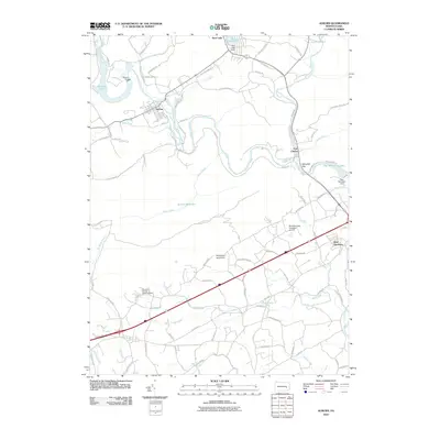
2010 Map of Auburn
USGS Topo · Published 2010About this map
The Schuylkill River carves a winding path through this corner of Berks and Schuylkill counties, defining the development of communities like Auburn and Port Clinton. The landscape is dominated by the ridges of Coal Mountain and Fork Mountain, with the river forcing a passage through the prominent Schuylkill Gap to the east. This 2010 survey illustrates the balance between water management and recreation, showing the Auburn Reservoir, Deer Lake, and the Mountain Springs Camping Resort nestled among the hills. Local transportation and infrastructure are prominent, from the Blue Mountain Academy Airport and Windswept Aerodrome to the sprawling State Game Lands 110 that preserves large tracts of the surrounding terrain.
Find a feature on this map
88 named features on this map. Tap any name to fly to it.
Don’t see what you’re looking for? This feature index may not catch every label — zoom into the map to look around manually.
Map Details
Editions of this 2010 Auburn Map
This is the sole edition of this map. No revisions or reprints were ever made.
Other maps of this area

1889 · Pottsville
USGS Topo · 1:62,500

1891 · Pottsville
USGS Topo · 1:62,500

1894 · Reading
USGS Topo · 1:62,500

1902 · Wernersville
USGS Topo · 1:62,500

1909 · Hamburg
USGS Topo · 1:62,500

1911 · Hamburg
USGS Topo · 1:62,500

1913 · Reading
USGS Topo · 1:62,500

1915 · Reading
USGS Topo · 1:62,500

1943 · Wernersville
USGS Topo · 1:62,500

1944 · Reading
USGS Topo · 1:62,500