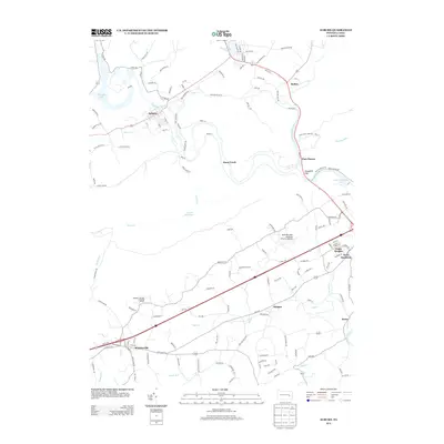
2013 Map of Auburn
USGS Topo · Published 2013About this map
The Schuylkill River and Little Schuylkill River converge near the Schuylkill Gap, a significant geographical passage through the mountain ridges of southeastern Pennsylvania. This corridor, historically vital for transport and industry, connects settlements such as Port Clinton and Auburn. The landscape is a complex network of waterways including Stony Creek, Mill Cr, and Northkill Cr, which have shaped the placement of local villages like Molino, Berne, and Jalappa.
Find a feature on this map
141 named features on this map. Tap any name to fly to it.
Don’t see what you’re looking for? This feature index may not catch every label — zoom into the map to look around manually.
Map Details
Editions of this 2013 Auburn Map
This is the sole edition of this map. No revisions or reprints were ever made.
Other maps of this area

1889 · Pottsville
USGS Topo · 1:62,500

1891 · Pottsville
USGS Topo · 1:62,500

1894 · Reading
USGS Topo · 1:62,500

1902 · Wernersville
USGS Topo · 1:62,500

1909 · Hamburg
USGS Topo · 1:62,500

1911 · Hamburg
USGS Topo · 1:62,500

1913 · Reading
USGS Topo · 1:62,500

1915 · Reading
USGS Topo · 1:62,500

1943 · Wernersville
USGS Topo · 1:62,500

1944 · Reading
USGS Topo · 1:62,500