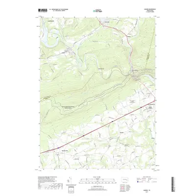
2019 Map of Auburn
USGS Topo · Published 2019About this map
The Schuylkill River and its tributary, the Little Schuylkill River, converge near the dramatic Schuylkill Gap, shaping the development of towns like Port Clinton and Auburn. This 2019 survey documents the complex geography where the river corridor meets the ridge of Blue Mountain, a landscape traversed by the Appalachian National Scenic Trail.
Find a feature on this map
133 named features on this map. Tap any name to fly to it.
Don’t see what you’re looking for? This feature index may not catch every label — zoom into the map to look around manually.
Map Details
Editions of this 2019 Auburn Map
This is the sole edition of this map. No revisions or reprints were ever made.
Other maps of this area

1889 · Pottsville
USGS Topo · 1:62,500

1891 · Pottsville
USGS Topo · 1:62,500

1894 · Reading
USGS Topo · 1:62,500

1902 · Wernersville
USGS Topo · 1:62,500

1909 · Hamburg
USGS Topo · 1:62,500

1911 · Hamburg
USGS Topo · 1:62,500

1913 · Reading
USGS Topo · 1:62,500

1915 · Reading
USGS Topo · 1:62,500

1943 · Wernersville
USGS Topo · 1:62,500

1944 · Reading
USGS Topo · 1:62,500