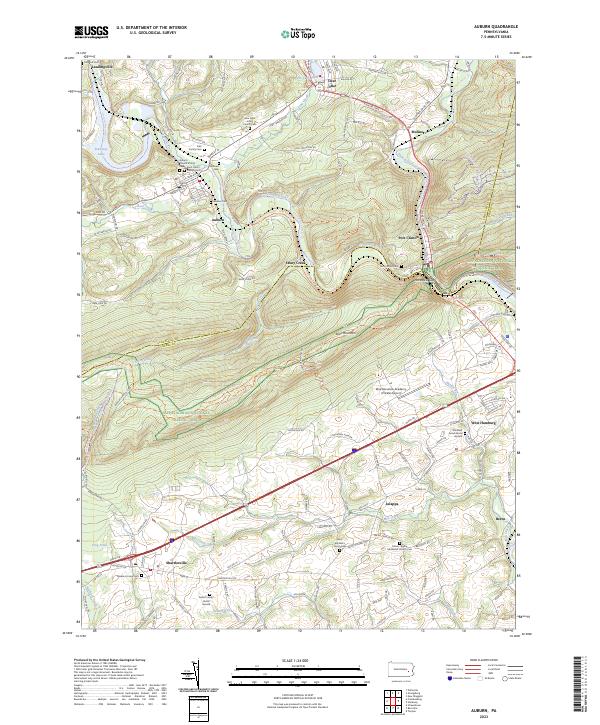
2023 Map of Auburn
USGS Topo · Published 2023About this map
The Schuylkill River and Little Schuylkill River converge near Port Clinton, defining a landscape where industrial transit corridors meet the steep ascent of Blue Mountain. This 2023 survey illustrates the enduring settlement patterns of northern Berks County, where small villages like Shartlesville, Jalappa, and Auburn are linked by a network of historic roads and modern thoroughfares. The map serves as a vital record for genealogists, documenting numerous small burial sites such as the Northkill Amish Burial Ground, Fahl Family Cem, and Seifert Family Burial Ground.
Find a feature on this map
148 named features on this map. Tap any name to fly to it.
Don’t see what you’re looking for? This feature index may not catch every label — zoom into the map to look around manually.
Map Details
Editions of this 2023 Auburn Map
This is the sole edition of this map. No revisions or reprints were ever made.
Other maps of this area

1889 · Pottsville
USGS Topo · 1:62,500

1891 · Pottsville
USGS Topo · 1:62,500

1894 · Reading
USGS Topo · 1:62,500

1902 · Wernersville
USGS Topo · 1:62,500

1909 · Hamburg
USGS Topo · 1:62,500

1911 · Hamburg
USGS Topo · 1:62,500

1913 · Reading
USGS Topo · 1:62,500

1915 · Reading
USGS Topo · 1:62,500

1943 · Wernersville
USGS Topo · 1:62,500

1944 · Reading
USGS Topo · 1:62,500