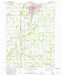
1973 Map of Auburn
USGS Topo · Published 1981About this map
The county seat of Auburn dominates this early 1970s landscape, serving as a vital regional hub where the Baltimore and Ohio Railroad and Penn Central Railroad intersect at Auburn Junction. The city's civic infrastructure is well-defined, featuring the central Courthouse, De Kalb Memorial Hospital, and Harrison Sch. Beyond the urban grid, the map documents a transition into the surrounding townships of Union and Jackson, where the land is etched by an extensive drainage network including the Diehl Ditch and North Branch Hursey Ditch. Local history is preserved in sites like Roselawn Cem and the rural Meese Ch, while the Auburn-DeKalb Airport and several Gravel Pits reflect the mid-century industrial and transportation development of DeKalb County.
Find a feature on this map
98 named features on this map. Tap any name to fly to it.
Don’t see what you’re looking for? This feature index may not catch every label — zoom into the map to look around manually.
Map Details
Editions of this 1973 Auburn Map
2 editions found
Other maps of this area

1953 · Fort Wayne
USGS Topo · 1:250,000

1955 · Corunna
USGS Topo · 1:24,000

1956 · Fort Wayne
USGS Topo · 1:250,000

1956 · Cedarville
USGS Topo · 1:24,000

1957 · Auburn
USGS Topo · 1:24,000

1957 · Waterloo
USGS Topo · 1:24,000

1957 · Huntertown
USGS Topo · 1:24,000

1957 · Garrett
USGS Topo · 1:24,000

1958 · Grabill
USGS Topo · 1:24,000

1958 · Butler West
USGS Topo · 1:24,000