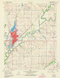
1961 Map of Augusta
USGS Topo · Published 1986About this map
Augusta serves as a major rail and industrial hub in this detailed 1960s study, updated with late-1970s urban expansions. The city's economic landscape is dominated by the sprawling Oil Refinery and a complex junction of the Atchison Topeka and Santa Fe and St Louis San Francisco railroads. The topography is defined by the convergence of the Whitewater River and Walnut River, with Augusta Lake and Garvin Park providing significant recreational spaces for the growing community.
Find a feature on this map
41 named features on this map. Tap any name to fly to it.
Don’t see what you’re looking for? This feature index may not catch every label — zoom into the map to look around manually.
Map Details
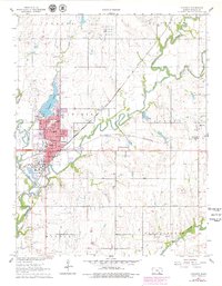
Editions of this 1961 Augusta Map
3 editions found
Other maps of this area

1888 · Eldorado
USGS Topo · 1:125,000

1889 · Wichita
USGS Topo · 1:125,000

1894 · Wichita
USGS Topo · 1:125,000

1955 · Santa Fe Lake
USGS Topo · 1:24,000

1955 · Benton
USGS Topo · 1:24,000

1955 · Douglass
USGS Topo · 1:24,000

1955 · Wichita
USGS Topo · 1:250,000

1958 · Wichita
USGS Topo · 1:250,000

1961 · Augusta
USGS Topo · 1:24,000

1961 · El Dorado
USGS Topo · 1:24,000