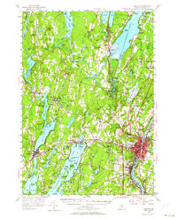
1956 Map of Augusta
USGS Topo · Published 1964About this map
Augusta and Hallowell anchor the Kennebec River corridor during the mid-1950s, a period marked by established state institutions and a thriving lakefront culture. The city center is dense with historic landmarks, including the State Hospital and the State School for Girls, while the Maine Central railroad tracks parallel the river's edge. Beyond the urban core, the landscape transitions into a sprawling network of water bodies and summer retreats. The western portion of the sheet is dominated by Maranacook Lake and Cobbosseecontee Lake, where seasonal life is evidenced by the Maranacook Camp and the recreational hub at Island Park. Small crossroads like Readfield Depot and Wings Mills reflect the region's agricultural and milling roots. Notable civic and religious sites, such as the Old South Ch in Belgrade and the Smith Memorial Ch in Readfield, provide essential points of interest for those tracing local family histories and 20th-century settlement patterns.
Find a feature on this map
138 named features on this map. Tap any name to fly to it.
Don’t see what you’re looking for? This feature index may not catch every label — zoom into the map to look around manually.
Map Details
Editions of this 1956 Augusta Map
4 editions found
Other maps of this area

1892 · Gardiner
USGS Topo · 1:62,500

1892 · Waterville
USGS Topo · 1:62,500

1892 · Augusta
USGS Topo · 1:62,500

1893 · Vassalboro
USGS Topo · 1:62,500

1893 · Wiscasset
USGS Topo · 1:62,500

1894 · Norridgewock
USGS Topo · 1:62,500

1898 · Norridgewock
USGS Topo · 1:62,500

1898 · Vassalboro
USGS Topo · 1:62,500

1908 · Lewiston
USGS Topo · 1:62,500

1910 · Livermore
USGS Topo · 1:62,500