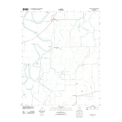
2011 Map of Augusta NE
USGS Topo · Published 2011About this map
The White River winds through this Jackson County landscape, creating a complex network of oxbow lakes, sloughs, and bars that define the region's geography. Meanders such as Cooper Bend and Baines Bend are flanked by numerous water bodies including Big Horseshoe Lake, Beaver Dam Lake, and Spradlin Lake. These natural features, alongside the Gibson Levee, illustrate the ongoing human effort to manage the alluvial environment for small rural settlements like Ingleside and Bengel.
Find a feature on this map
56 named features on this map. Tap any name to fly to it.
Don’t see what you’re looking for? This feature index may not catch every label — zoom into the map to look around manually.
Map Details
Editions of this 2011 Augusta NE Map
This is the sole edition of this map. No revisions or reprints were ever made.
Other maps of this area

1935 · Newport
USGS Topo · 1:62,500

1935 · Augusta
USGS Topo · 1:62,500

1935 · Tuckerman
USGS Topo · 1:62,500

1940 · Tilton
USGS Topo · 1:62,500

1953 · Memphis
USGS Topo · 1:250,000

1956 · Memphis
USGS Topo · 1:250,000

1956 · Tilton
USGS Topo · 1:62,500

1957 · Augusta
USGS Topo · 1:62,500
1962 · Olyphant
USGS Topo · 1:24,000

1962 · Newport
USGS Topo · 1:24,000