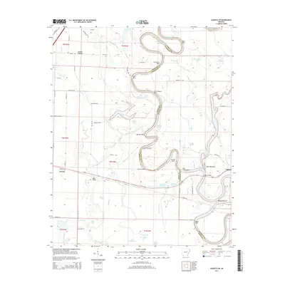
2014 Map of Augusta SW
USGS Topo · Published 2014About this map
The White River carves a serpentine path through the Arkansas lowlands, defining the boundary between White and Woodruff counties. This landscape is shaped by the water, featuring dramatic oxbows and bends like North Missouri Bend and Hawkins Bend. The river's influence is evident in the numerous namesake water bodies such as Big Jordan Lake, Horseshoe Lake, and Bacon Lake that dot the surrounding floodplains.
Find a feature on this map
86 named features on this map. Tap any name to fly to it.
Don’t see what you’re looking for? This feature index may not catch every label — zoom into the map to look around manually.
Map Details
Editions of this 2014 Augusta SW Map
This is the sole edition of this map. No revisions or reprints were ever made.
Other maps of this area

1932 · Kensett
USGS Topo · 1:62,500

1935 · Kensett
USGS Topo · 1:62,500

1935 · Augusta
USGS Topo · 1:62,500

1935 · Gregory
USGS Topo · 1:62,500

1935 · Bald Knob
USGS Topo · 1:62,500

1953 · Memphis
USGS Topo · 1:250,000

1956 · Memphis
USGS Topo · 1:250,000

1957 · Augusta
USGS Topo · 1:62,500

1957 · Gregory
USGS Topo · 1:62,500
1964 · West Point
USGS Topo · 1:24,000