
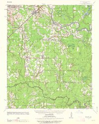
1935 Map of Kensett
USGS Topo · Published 1935About this map
The Little Red River meanders across this mid-1930s landscape, defining a region of dense river-bottom topography and prairie land. Significant rail infrastructure is centered around Kensett and Higginson, where the Missouri Pacific lines converge to support the local timber and agricultural economy. The map reveals a high density of rural institutions, such as Pleasant Grove Ch and Williams Sch, which served the scattered farmsteads of the era.
Find a feature on this map
56 named features on this map. Tap any name to fly to it.
Don’t see what you’re looking for? This feature index may not catch every label — zoom into the map to look around manually.
Map Details
Editions of this 1935 Kensett Map
2 editions found
Other maps of this area

1932 · Kensett
USGS Topo · 1:62,500

1935 · Hazen
USGS Topo · 1:62,500

1935 · Augusta
USGS Topo · 1:62,500

1935 · Gregory
USGS Topo · 1:62,500

1935 · Bald Knob
USGS Topo · 1:62,500

1940 · Lonoke
USGS Topo · 1:62,500

1941 · Hazen
USGS Topo · 1:62,500

1941 · De Valls Bluff
USGS Topo · 1:62,500

1948 · Helena
USGS Topo · 1:250,000

1949 · Lonoke
USGS Topo · 1:62,500