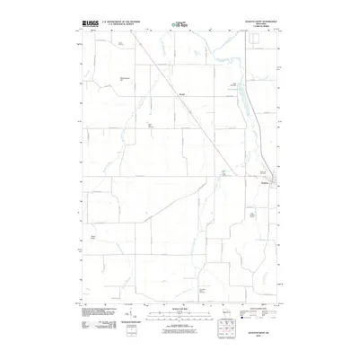
2010 Map of Augusta West
USGS Topo · Published 2010About this map
Bridge Creek and the Eau Claire River converge in this western portion of the Augusta area, where the Dells Lake Dam creates the distinct Dells Millpond. The landscape is a network of small watercourses like Bears Grass Creek and Thompson Valley Creek that weave through local landmarks such as Moldenhauer Hill and Scott Valley. This 2010 survey illustrates the rural distribution of family-named road networks and religious heritage sites, including Lincoln Cemetery, Saint Peter Cemetery, and Thompson Valley Cemetery. The small settlement of Rodell serves as a central junction point northwest of the city of Augusta, while the presence of the Sieg Landing Strip near the First Trestle Creek drainage suggests the continued importance of private aviation in this part of Eau Claire County.
Find a feature on this map
53 named features on this map. Tap any name to fly to it.
Don’t see what you’re looking for? This feature index may not catch every label — zoom into the map to look around manually.
Map Details
Editions of this 2010 Augusta West Map
This is the sole edition of this map. No revisions or reprints were ever made.
Other maps of this area

1927 · Strum
USGS Topo · 1:62,500

1930 · Strum
USGS Topo · 1:62,500

1934 · Chippewa Falls
USGS Topo · 1:62,500

1935 · Osseo
USGS Topo · 1:48,000

1936 · Chippewa Falls
USGS Topo · 1:62,500

1940 · Osseo
USGS Topo · 1:62,500

1952 · Cadott
USGS Topo · 1:62,500

1953 · Eau Claire
USGS Topo · 1:250,000

1958 · Eau Claire
USGS Topo · 1:250,000

1964 · Eau Claire
USGS Topo · 1:250,000