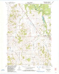
1984 Map of Augusta West
USGS Topo · Published 1984About this map
Eau Claire River meanders through the northern reaches of this rural landscape, bordered by Harstad Co Park and the waters of Dells Millpond. The western edge of Augusta appears on the eastern margin, while the small settlement of Rodell serves as a waypoint along the Chicago and North Western railroad line. The map reveals a deeply rooted rural community, marked by family-named infrastructure like Von Haden Road and Livermore Road that connect scattered farmsteads across the townships of Lincoln, Otter Creek, and Bridge Creek. Local history is anchored by several country burial grounds and schoolhouses, including St Peters Cem and the Plain View Sch, illustrating the persistence of late 20th-century agricultural life. Numerous gravel pits and the Sieg Landing Strip indicate the local industrial and utility footprint within this river-veined terrain.
Find a feature on this map
45 named features on this map. Tap any name to fly to it.
Don’t see what you’re looking for? This feature index may not catch every label — zoom into the map to look around manually.
Map Details
Editions of this 1984 Augusta West Map
This is the sole edition of this map. No revisions or reprints were ever made.
Other maps of this area

1927 · Strum
USGS Topo · 1:62,500

1930 · Strum
USGS Topo · 1:62,500

1934 · Chippewa Falls
USGS Topo · 1:62,500

1935 · Osseo
USGS Topo · 1:48,000

1936 · Chippewa Falls
USGS Topo · 1:62,500

1940 · Osseo
USGS Topo · 1:62,500

1952 · Cadott
USGS Topo · 1:62,500

1953 · Eau Claire
USGS Topo · 1:250,000

1958 · Eau Claire
USGS Topo · 1:250,000

1964 · Eau Claire
USGS Topo · 1:250,000