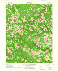
1962 Map of Ault
USGS Topo · Published 1964About this map
Stark and Gimlet anchor this 1962 topographic landscape where the borders of Elliott, Carter, and Rowan counties meet. The settlement pattern is defined by the deep valleys of Caney Creek and Big Sinking Creek, where small post offices, schools, and family cemeteries served dispersed Appalachian communities. Unique cultural landmarks include Ordinary, Dewdrop, and Beartown, while the Olive Hill Airport in the northern reaches near Tarkiln Creek indicates the mid-century intersection of traditional geography and modern infrastructure. Genealogists will find significant value in the identification of sites such as Mary Mabry Cem, the Pennington Cemetery, and the Bunker Hill School, which provide specific locations for family roots in this hilly terrain before later transitions in the rural Kentucky landscape.
Find a feature on this map
61 named features on this map. Tap any name to fly to it.
Don’t see what you’re looking for? This feature index may not catch every label — zoom into the map to look around manually.
Map Details
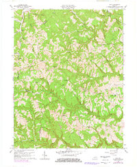
Editions of this 1962 Ault Map
2 editions found
Other maps of this area

1929 · Morehead
USGS Topo · 1:48,000

1935 · Morehead
USGS Topo · 1:62,500

1950 · Bruin
USGS Topo · 1:24,000

1950 · Grahn
USGS Topo · 1:24,000

1950 · Isonville
USGS Topo · 1:24,000

1950 · Olive Hill
USGS Topo · 1:24,000

1950 · Ault
USGS Topo · 1:24,000

1950 · Sandy Hook
USGS Topo · 1:24,000

1951 · Soldier
USGS Topo · 1:24,000

1953 · Haldeman
USGS Topo · 1:24,000