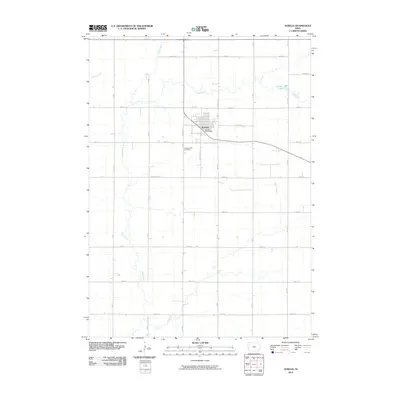
2010 Map of Aurelia
USGS Topo · Published 2010About this map
The town of Aurelia sits at the heart of this Cherokee County agricultural landscape, defined by a grid of rural roads and the meandering courses of local waterways. The community is anchored by the Aurelia Post Office and the nearby Pleasant Hill Cemetery, providing a clear view of the town's structural layout in the early 21st century. To the west and south, the Maple River and its various tributaries, including Maple Creek and Pitcher Creek, carve across the prairie, while Larson Lake and Coonley Creek mark the northern reaches of the quadrangle. The map documents the persistent agricultural grid established by routes like Pitcher Dr and Wood Chip Rd, showing the relationship between small-town Iowa infrastructure and the natural drainage patterns of the region.
Find a feature on this map
26 named features on this map. Tap any name to fly to it.
Don’t see what you’re looking for? This feature index may not catch every label — zoom into the map to look around manually.
Map Details
Editions of this 2010 Aurelia Map
This is the sole edition of this map. No revisions or reprints were ever made.
Other maps of this area

1954 · Fort Dodge
USGS Topo · 1:250,000

1957 · Fort Dodge
USGS Topo · 1:250,000

1958 · Fort Dodge
USGS Topo · 1:250,000

1969 · Aurelia
USGS Topo · 1:24,000

1969 · Cherokee South
USGS Topo · 1:24,000

1969 · Galva
USGS Topo · 1:24,000

1969 · Quimby SE
USGS Topo · 1:24,000

1971 · Peterson SW
USGS Topo · 1:24,000

1971 · Peterson SE
USGS Topo · 1:24,000
1971 · Cherokee North
USGS Topo · 1:24,000