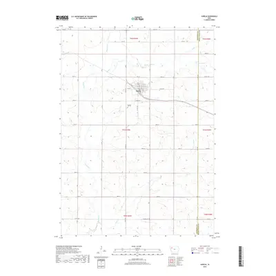
2018 Map of Aurelia
USGS Topo · Published 2018About this map
The town of Aurelia serves as the central hub for this portion of Northwest Iowa, where a grid of streets including Main St, Walnut St, and Myrtle St reflects the organized development of this agricultural community. Just south of the town center lies the Pleasant Hill Cem, a significant site for local genealogical research. The landscape is defined by the winding course of the Maple River and its various tributaries like Coonley Cr and Maple Cr, which cut through the drainage basins of the region.
Find a feature on this map
40 named features on this map. Tap any name to fly to it.
Don’t see what you’re looking for? This feature index may not catch every label — zoom into the map to look around manually.
Map Details
Editions of this 2018 Aurelia Map
This is the sole edition of this map. No revisions or reprints were ever made.
Other maps of this area

1954 · Fort Dodge
USGS Topo · 1:250,000

1957 · Fort Dodge
USGS Topo · 1:250,000

1958 · Fort Dodge
USGS Topo · 1:250,000

1969 · Aurelia
USGS Topo · 1:24,000

1969 · Cherokee South
USGS Topo · 1:24,000

1969 · Galva
USGS Topo · 1:24,000

1969 · Quimby SE
USGS Topo · 1:24,000

1971 · Peterson SW
USGS Topo · 1:24,000

1971 · Peterson SE
USGS Topo · 1:24,000
1971 · Cherokee North
USGS Topo · 1:24,000