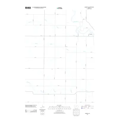
2013 Map of Aureola
USGS Topo · Published 2013About this map
Shell Rock River winds through the northeastern corner of this Iowa landscape, where the small settlement of Aureola sits near the river's bend. The area is defined by a dense grid of rural corridors, including Dancer Ave, Echo Ave, and Hickory Ave, which facilitate movement across an agricultural terrain drained by several named waterways. In addition to the river, the landscape is shaped by Beemis Cr, Ackley Cr, and Coldwater Cr, reflecting the natural drainage patterns that have historically dictated farm placement and local infrastructure. Central to the sheet is the locale of Scott, positioned at the intersection of 300th St and Dancer Ave, serving as a navigational reference point for this portion of Floyd County.
Find a feature on this map
32 named features on this map. Tap any name to fly to it.
Don’t see what you’re looking for? This feature index may not catch every label — zoom into the map to look around manually.
Map Details
Editions of this 2013 Aureola Map
This is the sole edition of this map. No revisions or reprints were ever made.
Other maps of this area

1954 · Mason City
USGS Topo · 1:250,000

1954 · Waterloo
USGS Topo · 1:250,000

1955 · Waterloo
USGS Topo · 1:250,000

1957 · Mason City
USGS Topo · 1:250,000

1958 · Mason City
USGS Topo · 1:250,000

1959 · Mason City
USGS Topo · 1:62,500

1959 · Mason City SE
USGS Topo · 1:24,000

1971 · Rockford
USGS Topo · 1:24,000
1971 · Roseville
USGS Topo · 1:24,000

1972 · Dumont North
USGS Topo · 1:24,000