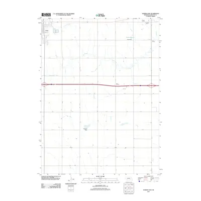
2011 Map of Aurora East
USGS Topo · Published 2011About this map
Aurora anchors the western edge of this agricultural landscape in Hamilton County, where the grid of rural roads defines the movement of people and commerce. The terrain is shaped by the subtle drainages of Lincoln Creek in the north and Beaver Creek winding through the central sections. Water management is evident through the presence of the Peetzke Reservoir, held by the Peetzke Dam, and the depression of Bergeson Basin to the south. For those tracing family histories in Nebraska, this 2011 survey provides precise locations for several local burial grounds, including Hampton Cemetery, Youst Cemetery, and Salem Cemetery. The map captures a moment of modern rural continuity, showing the structured township system that has organized this prairie region for generations.
Find a feature on this map
27 named features on this map. Tap any name to fly to it.
Don’t see what you’re looking for? This feature index may not catch every label — zoom into the map to look around manually.
Map Details
Editions of this 2011 Aurora East Map
This is the sole edition of this map. No revisions or reprints were ever made.
Other maps of this area

1898 · York
USGS Topo · 1:125,000

1898 · Grand Island
USGS Topo · 1:125,000

1899 · York
USGS Topo · 1:125,000

1955 · Lincoln
USGS Topo · 1:250,000

1955 · Grand Island
USGS Topo · 1:250,000

1957 · Lincoln
USGS Topo · 1:250,000

1957 · Grand Island
USGS Topo · 1:250,000

1958 · Grand Island
USGS Topo · 1:250,000

1958 · Lincoln
USGS Topo · 1:250,000
1968 · Aurora West
USGS Topo · 1:24,000