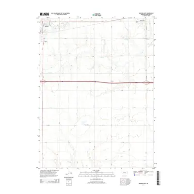
2014 Map of Aurora East
USGS Topo · Published 2014About this map
Aurora and Hampton anchor the northern landscape of this Hamilton County region, connected by the transit corridors of Us-34 and a grid of rural roads. The agricultural character of the plains is punctuated by localized water features such as Peetzke Reservoir and the expansive Bergeson Basin. The drainage patterns of Lincoln Cr and Beaver Cr provide the primary relief to the terrain, shaping the distribution of farmsteads across the township sections. This 2014 survey documents the enduring presence of local history through sites like Hampton Cem, Youst Cem, and Salem Cem, which serve as critical markers for genealogical research. The map illustrates a modern rural infrastructure where established township boundaries meet late-century highway developments, maintaining the core layout of these Nebraska communities while accommodating the infrastructure of the Interstate era.
Find a feature on this map
39 named features on this map. Tap any name to fly to it.
Don’t see what you’re looking for? This feature index may not catch every label — zoom into the map to look around manually.
Map Details
Editions of this 2014 Aurora East Map
This is the sole edition of this map. No revisions or reprints were ever made.
Other maps of this area

1898 · York
USGS Topo · 1:125,000

1898 · Grand Island
USGS Topo · 1:125,000

1899 · York
USGS Topo · 1:125,000

1955 · Lincoln
USGS Topo · 1:250,000

1955 · Grand Island
USGS Topo · 1:250,000

1957 · Lincoln
USGS Topo · 1:250,000

1957 · Grand Island
USGS Topo · 1:250,000

1958 · Grand Island
USGS Topo · 1:250,000

1958 · Lincoln
USGS Topo · 1:250,000
1968 · Aurora West
USGS Topo · 1:24,000