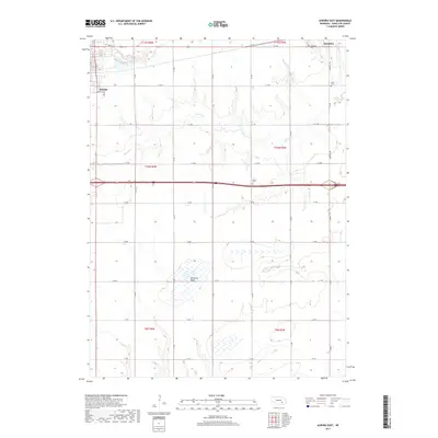
2017 Map of Aurora East
USGS Topo · Published 2017About this map
The city of Aurora sits on the western edge of this agricultural landscape in Hamilton County, serving as a hub for the surrounding township grids. In the late 2010s, the terrain remains defined by its water systems, including the meandering path of Beaver Cr and the northern flow of Lincoln Cr. Evidence of the area's early settlement is preserved in the local cemeteries that punctuate the rural sections, such as Salem Cem located near the intersection of modern transit corridors and the historic Youst Cem to the east. The map illustrates the sophisticated water management of the Plains, highlighting features like Bergeson Basin and Peetzke Reservoir. To the northeast, the town of Hampton anchors the map, connected to the county seat by a network of well-ordered section roads that follow the original public land surveys.
Find a feature on this map
46 named features on this map. Tap any name to fly to it.
Don’t see what you’re looking for? This feature index may not catch every label — zoom into the map to look around manually.
Map Details
Editions of this 2017 Aurora East Map
This is the sole edition of this map. No revisions or reprints were ever made.
Other maps of this area

1898 · York
USGS Topo · 1:125,000

1898 · Grand Island
USGS Topo · 1:125,000

1899 · York
USGS Topo · 1:125,000

1955 · Lincoln
USGS Topo · 1:250,000

1955 · Grand Island
USGS Topo · 1:250,000

1957 · Lincoln
USGS Topo · 1:250,000

1957 · Grand Island
USGS Topo · 1:250,000

1958 · Grand Island
USGS Topo · 1:250,000

1958 · Lincoln
USGS Topo · 1:250,000
1968 · Aurora West
USGS Topo · 1:24,000