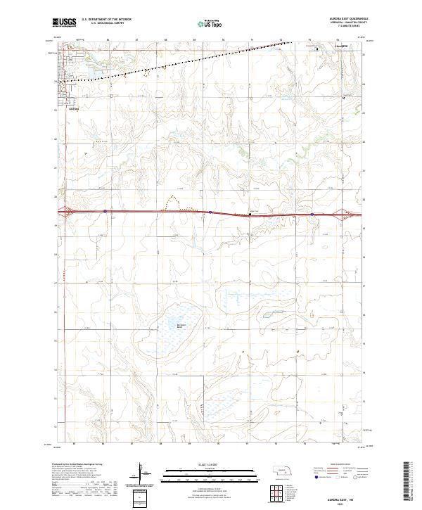
2021 Map of Aurora East
USGS Topo · Published 2021About this map
The city of Aurora sits on the western edge of this Hamilton County landscape, where the street grid transitions into a vast network of section roads and agricultural drainages. This high-plains terrain is defined by the eastward flow of Beaver Cr and Lincoln Cr, which cut through the level topography typical of this part of Nebraska. The area's settlement pattern is anchored by small rural centers like Hampton in the northeast and several family or community landmarks that have endured for generations.
Find a feature on this map
33 named features on this map. Tap any name to fly to it.
Don’t see what you’re looking for? This feature index may not catch every label — zoom into the map to look around manually.
Map Details
Editions of this 2021 Aurora East Map
This is the sole edition of this map. No revisions or reprints were ever made.
Other maps of this area

1898 · York
USGS Topo · 1:125,000

1898 · Grand Island
USGS Topo · 1:125,000

1899 · York
USGS Topo · 1:125,000

1955 · Lincoln
USGS Topo · 1:250,000

1955 · Grand Island
USGS Topo · 1:250,000

1957 · Lincoln
USGS Topo · 1:250,000

1957 · Grand Island
USGS Topo · 1:250,000

1958 · Grand Island
USGS Topo · 1:250,000

1958 · Lincoln
USGS Topo · 1:250,000
1968 · Aurora West
USGS Topo · 1:24,000