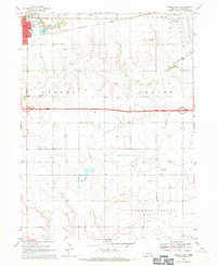
1968 Map of Aurora East
USGS Topo · Published 1971About this map
Aurora serves as the western anchor of this Hamilton County landscape, where the town's early footprint includes Streeter Park and the local country club. The topography is defined by the shallow valleys of Lincoln Creek and Beaver Creek, alongside the seasonal Bergeson Basin. This era shows a transition in regional transit, with the older Chicago and North Western rail line and the newly established corridor of Interstate 80 cutting through the agricultural heartland.
Find a feature on this map
21 named features on this map. Tap any name to fly to it.
Don’t see what you’re looking for? This feature index may not catch every label — zoom into the map to look around manually.
Map Details
Editions of this 1968 Aurora East Map
This is the sole edition of this map. No revisions or reprints were ever made.
Other maps of this area

1898 · York
USGS Topo · 1:125,000

1898 · Grand Island
USGS Topo · 1:125,000

1899 · York
USGS Topo · 1:125,000

1955 · Lincoln
USGS Topo · 1:250,000

1955 · Grand Island
USGS Topo · 1:250,000

1957 · Lincoln
USGS Topo · 1:250,000

1957 · Grand Island
USGS Topo · 1:250,000

1958 · Grand Island
USGS Topo · 1:250,000

1958 · Lincoln
USGS Topo · 1:250,000
1968 · Aurora West
USGS Topo · 1:24,000