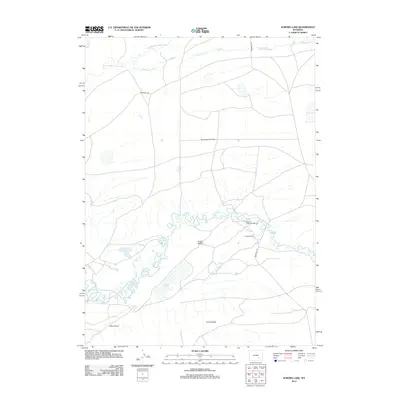
2012 Map of Aurora Lake
USGS Topo · Published 2012About this map
Como Bluffs and Como Ridge dominate this section of Albany County, where the high desert terrain transitions between rugged ridges and the expansive Greasewood Flats. This early 21st-century landscape is defined by its water management and ranching heritage, notably featuring the Como Bluff Fish Hatchery and the Carlin Ranch. The hydrology of the area is centered around the Little Medicine Bow River, which meanders through the central portion of the map, and the namesake Aurora Lake situated to the south. Other significant geographic markers include the aptly named Robbers Roost and Ambler Spring. Access to these remote Wyoming lands remains focused on Marshall Rd, which serves the small pockets of human development amidst the vast natural drainages of Greasewood Cr and Muddy Cr.
Find a feature on this map
13 named features on this map. Tap any name to fly to it.
Don’t see what you’re looking for? This feature index may not catch every label — zoom into the map to look around manually.
Map Details
Editions of this 2012 Aurora Lake Map
This is the sole edition of this map. No revisions or reprints were ever made.
Other maps of this area

1915 · Como Ridge
USGS Topo · 1:48,000

1918 · Como Ridge
USGS Topo · 1:62,500

1954 · Torrington
USGS Topo · 1:250,000

1954 · Cheyenne
USGS Topo · 1:250,000

1954 · Rawlins
USGS Topo · 1:250,000

1955 · Pine Tree Ridge
USGS Topo · 1:24,000

1955 · Wilcox
USGS Topo · 1:24,000

1955 · Casper
USGS Topo · 1:250,000

1958 · Rawlins
USGS Topo · 1:250,000

1958 · Casper
USGS Topo · 1:250,000