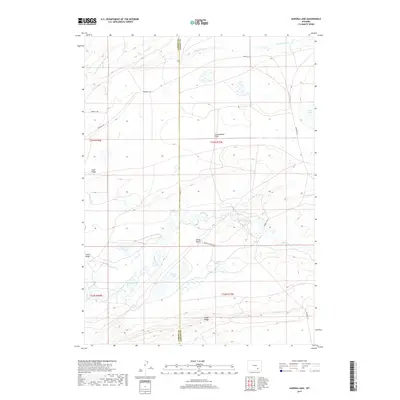
2017 Map of Aurora Lake
USGS Topo · Published 2017About this map
Como Bluffs and Como Ridge dominate the southern landscape of this 2017 survey, marking a region famous for its significant paleontological history along the border of Albany and Carbon counties. The terrain is defined by a series of distinct geological uplifts, including Fossil Ridge and Slate Ridge, which steer the path of local waterways like Rock Creek as it winds toward the center of the quadrangle. High-altitude hydrology is a focal point here, with Aurora Lake and the seasonally variable Dry Lake situated among expansive plains such as Greasewood Flats. While modern infrastructure is represented by routes like Marshall Rd and Equality Rd, the map primarily illustrates a high-desert environment where the Little Medicine Bow River and isolated water sources like Ambler Spring dictate the character of the land.
Find a feature on this map
19 named features on this map. Tap any name to fly to it.
Don’t see what you’re looking for? This feature index may not catch every label — zoom into the map to look around manually.
Map Details
Editions of this 2017 Aurora Lake Map
This is the sole edition of this map. No revisions or reprints were ever made.
Other maps of this area

1915 · Como Ridge
USGS Topo · 1:48,000

1918 · Como Ridge
USGS Topo · 1:62,500

1954 · Torrington
USGS Topo · 1:250,000

1954 · Cheyenne
USGS Topo · 1:250,000

1954 · Rawlins
USGS Topo · 1:250,000

1955 · Pine Tree Ridge
USGS Topo · 1:24,000

1955 · Wilcox
USGS Topo · 1:24,000

1955 · Casper
USGS Topo · 1:250,000

1958 · Rawlins
USGS Topo · 1:250,000

1958 · Casper
USGS Topo · 1:250,000