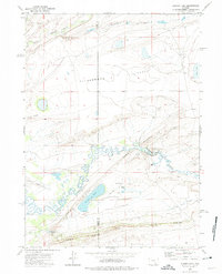
1971 Map of Aurora Lake
USGS Topo · Published 1975About this map
Como Ridge and Fossil Ridge dominate this corner of the Wyoming landscape, where the Carbon Co Albany Co line splits the high plains. The terrain is defined by a series of dramatic escarpments and dry flats, punctuated by the winding course of Como Creek and the Medicine Bow River. This 1971 survey captures a rural environment where water management is critical, evidenced by an Aqueduct system and a Flowing Well feeding into Aurora Lake.
Find a feature on this map
22 named features on this map. Tap any name to fly to it.
Don’t see what you’re looking for? This feature index may not catch every label — zoom into the map to look around manually.
Map Details
Editions of this 1971 Aurora Lake Map
This is the sole edition of this map. No revisions or reprints were ever made.
Other maps of this area

1915 · Como Ridge
USGS Topo · 1:48,000

1918 · Como Ridge
USGS Topo · 1:62,500

1954 · Torrington
USGS Topo · 1:250,000

1954 · Cheyenne
USGS Topo · 1:250,000

1954 · Rawlins
USGS Topo · 1:250,000

1955 · Pine Tree Ridge
USGS Topo · 1:24,000

1955 · Wilcox
USGS Topo · 1:24,000

1955 · Casper
USGS Topo · 1:250,000

1958 · Rawlins
USGS Topo · 1:250,000

1958 · Casper
USGS Topo · 1:250,000