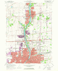
1964 Map of Aurora North
USGS Topo · Published 1973About this map
The Fox River carves through the industrial heart of Kane County, serving as the central artery for the growing cities of Batavia and Aurora. By the early 1970s, the landscape shows a dense network of institutional and religious infrastructure, including the Marmion Military Academy and Aurora College. This era marks the significant expansion of the National Accelerator Laboratory along the eastern edge, a facility that transformed the former agricultural fields into a hub of scientific research.
Find a feature on this map
86 named features on this map. Tap any name to fly to it.
Don’t see what you’re looking for? This feature index may not catch every label — zoom into the map to look around manually.
Map Details
Editions of this 1964 Aurora North Map
Other maps of this area

1892 · Joliet
USGS Topo · 1:62,500

1908 · Wheaton
USGS Topo · 1:62,500

1923 · Joliet
USGS Topo · 1:62,500

1925 · Yorkville
USGS Topo · 1:62,500

1932 · Geneva
USGS Topo · 1:62,500

1948 · Wheaton
USGS Topo · 1:62,500

1948 · Geneva
USGS Topo · 1:62,500

1949 · Geneva
USGS Topo · 1:24,000

1950 · Aurora North
USGS Topo · 1:24,000

1953 · Naperville
USGS Topo · 1:24,000