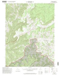
1995 Map of Aurora
USGS Topo · Published 1998About this map
Cathedral State Park stands as a focal point in this portion of Preston County, preserving a rare pocket of ancient forest amidst the ridges of the Allegheny Mountains. The landscape is defined by significant elevation changes, with Shaffer Mountain and Brushy Knobs overlooking the valley settlements. The historic George Washington Highway serves as the primary artery, connecting the small communities of Aurora, Brookside, and Dayton.
Find a feature on this map
42 named features on this map. Tap any name to fly to it.
Don’t see what you’re looking for? This feature index may not catch every label — zoom into the map to look around manually.
Map Details
Editions of this 1995 Aurora Map
2 editions found
Other maps of this area

1886 · St. George
USGS Topo · 1:125,000

1891 · St. George
USGS Topo · 1:125,000

1895 · Piedmont
USGS Topo · 1:125,000

1899 · Oakland
USGS Topo · 1:62,500

1900 · Oakland
USGS Topo · 1:62,500

1907 · Kingwood
USGS Topo · 1:62,500

1908 · Parsons
USGS Topo · 1:62,500

1916 · Davis
USGS Topo · 1:48,000

1918 · Davis
USGS Topo · 1:62,500

1919 · Davis
USGS Topo · 1:62,500