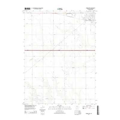
2014 Map of Aurora West
USGS Topo · Published 2014About this map
The western edges of Aurora anchor this landscape, where the town's residential grid meets the expansive agricultural terrain of Hamilton County. Significant for local family historians, the map documents the locations of Prairie Gem Cem and Seaton Cem, which serve as quiet landmarks among the section-line roads. The hydrology of the area is defined by the winding course of Beaver Cr and the drainage of the N Br W Fork Big Blue River in the south. Human-made water management is evident at the Kostal-Hawthorne Dam, which creates the Kostal Reservoir. Transportation infrastructure is a dominant feature, with Us-34 and 80 cutting east-west across the plains, while the residential streets of the county seat—including Railroad Ave and Jennifer Rd—cluster in the northeastern corner of the quadrangle.
Find a feature on this map
41 named features on this map. Tap any name to fly to it.
Don’t see what you’re looking for? This feature index may not catch every label — zoom into the map to look around manually.
Map Details
Editions of this 2014 Aurora West Map
This is the sole edition of this map. No revisions or reprints were ever made.
Other maps of this area

1898 · York
USGS Topo · 1:125,000

1898 · Grand Island
USGS Topo · 1:125,000

1899 · York
USGS Topo · 1:125,000

1955 · Lincoln
USGS Topo · 1:250,000

1955 · Grand Island
USGS Topo · 1:250,000

1957 · Lincoln
USGS Topo · 1:250,000

1957 · Grand Island
USGS Topo · 1:250,000

1958 · Grand Island
USGS Topo · 1:250,000

1958 · Lincoln
USGS Topo · 1:250,000
1962 · Phillips
USGS Topo · 1:24,000