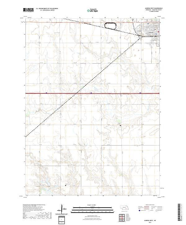
2021 Map of Aurora West
USGS Topo · Published 2021About this map
The Hamilton County Courthouse stands as the central landmark of Aurora, anchoring a grid of streets that extend westward toward the agricultural heart of Hamilton County. This 2021 study captures the town's modern footprint, including residential developments near Cottage Park Dr and the industrial activity along Railroad Ave. Outside the town center, the landscape is defined by the section-line road network and the winding path of Beaver Cr, which carves through the prairie landscape. To the south, the N Br W Fork Big Blue River is managed by water infrastructure like the Kostal Hawthorne Dam, which creates the Kostal Reservoir. For those researching local heritage, the map identifies significant burial sites including Prairie Gem Cem and Seaton Cem, preserving their locations within the rural townships.
Find a feature on this map
59 named features on this map. Tap any name to fly to it.
Don’t see what you’re looking for? This feature index may not catch every label — zoom into the map to look around manually.
Map Details
Editions of this 2021 Aurora West Map
This is the sole edition of this map. No revisions or reprints were ever made.
Other maps of this area

1898 · York
USGS Topo · 1:125,000

1898 · Grand Island
USGS Topo · 1:125,000

1899 · York
USGS Topo · 1:125,000

1955 · Lincoln
USGS Topo · 1:250,000

1955 · Grand Island
USGS Topo · 1:250,000

1957 · Lincoln
USGS Topo · 1:250,000

1957 · Grand Island
USGS Topo · 1:250,000

1958 · Grand Island
USGS Topo · 1:250,000

1958 · Lincoln
USGS Topo · 1:250,000
1962 · Phillips
USGS Topo · 1:24,000