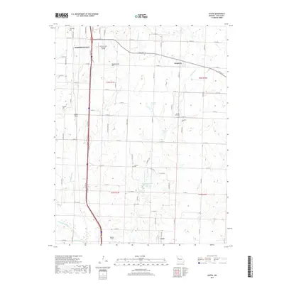
2017 Map of Austin
USGS Topo · Published 2017About this map
Harrisonville anchors the northwest corner of this Cass County landscape, where the urban edge of the city meets the agricultural expanses of western Missouri. The terrain is defined by a series of prominent elevations including Snowball Hill, Bodenhammer Hill, and Emrick Hill, which overlook a network of watercourses like Eightmile Cr and Tennessee Cr. This modern survey reveals a countryside punctuated by small historic nodes such as Daugherty and Austin, alongside the legacy of local families preserved in the Pleasant Valley Cem, Reed Cem, and Vansandt Cem.
Find a feature on this map
79 named features on this map. Tap any name to fly to it.
Don’t see what you’re looking for? This feature index may not catch every label — zoom into the map to look around manually.
Map Details
Editions of this 2017 Austin Map
This is the sole edition of this map. No revisions or reprints were ever made.
Other maps of this area

1887 · Harrisonville
USGS Topo · 1:125,000

1887 · Butler
USGS Topo · 1:125,000

1892 · Harrisonville
USGS Topo · 1:125,000

1894 · Harrisonville
USGS Topo · 1:125,000

1894 · Butler
USGS Topo · 1:125,000

1947 · Lawrence
USGS Topo · 1:250,000

1950 · Lawrence
USGS Topo · 1:250,000
1953 · Everett
USGS Topo · 1:24,000

1954 · Harrisonville
USGS Topo · 1:24,000
1954 · East Lynne
USGS Topo · 1:24,000