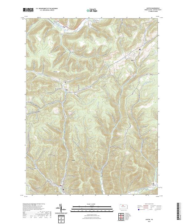
2023 Map of Austin
USGS Topo · Published 2023About this map
Austin occupies the valley where Freeman Run joins its south and east branches, serving as a focal point for this Potter County landscape. The town's grid, including Rugaber St and W Main St, is surrounded by a dense network of hollows and ridges, such as Dividing Ridge and Mina Hill. Local history is preserved in several small burial grounds like the Austin - Goodyear Cem and the Homer Cem near the settlement of Inez. To the north, the Allegheny River flows past Mina, where the Ranch-Aero Airport provides a small aviation footprint in the narrow river bottom. The geography is defined by deep incisions like Bark Shanty Hollow and Pump Station Hollow, illustrating the complex drainage patterns that feed into First Fork Sinnemahoning Creek.
Find a feature on this map
82 named features on this map. Tap any name to fly to it.
Don’t see what you’re looking for? This feature index may not catch every label — zoom into the map to look around manually.
Map Details
Editions of this 2023 Austin Map
This is the sole edition of this map. No revisions or reprints were ever made.
Other maps of this area

1932 · Genesee
USGS Topo · 1:62,500

1934 · Coudersport
USGS Topo · 1:48,000

1937 · Genesee
USGS Topo · 1:62,500

1938 · Coudersport
USGS Topo · 1:62,500

1947 · Conrad
USGS Topo · 1:62,500

1947 · Conrad
USGS Topo · 1:24,000

1947 · Ayers Hill
USGS Topo · 1:24,000

1948 · Emporium
USGS Topo · 1:62,500

1948 · Keating Summit
USGS Topo · 1:24,000

1948 · Emporium
USGS Topo · 1:24,000