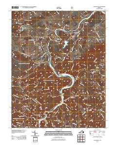
2011 Map of Austinville
USGS Topo · Published 2011About this map
The New River winds through this Wythe County landscape, dictating the development of mining settlements and hydroelectric infrastructure. Evidence of the region's industrial past is visible in several deep-earth structures, including the Flatwood Shaft, Van Mater Shaft, and Ivanhoe Shaft. These mining locations are interspersed with historical hamlets such as Ivanhoe, Austinville, and Byllesby, where the river's power is harnessed by the Byllesby Dam and Buck Dam. The conversion of old rail corridors into the New River Trail State Park marks a shift from a transit-heavy resource economy to preservation.
Find a feature on this map
59 named features on this map. Tap any name to fly to it.
Don’t see what you’re looking for? This feature index may not catch every label — zoom into the map to look around manually.
Map Details
Editions of this 2011 Austinville Map
This is the sole edition of this map. No revisions or reprints were ever made.
Other maps of this area

1889 · Hillsville
USGS Topo · 1:125,000

1889 · Wytheville
USGS Topo · 1:125,000

1892 · Hillsville
USGS Topo · 1:125,000

1892 · Wytheville
USGS Topo · 1:125,000

1896 · Hillsville
USGS Topo · 1:125,000

1930 · Speedwell
USGS Topo · 1:62,500

1930 · Independence
USGS Topo · 1:48,000

1930 · Max Meadows
USGS Topo · 1:62,500

1931 · Galax
USGS Topo · 1:48,000

1933 · Independence
USGS Topo · 1:62,500