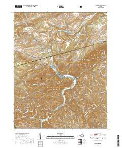
2019 Map of Austinville
USGS Topo · Published 2019About this map
The New River carves a winding path through this region of Southwest Virginia, defining the landscape between Ivanhoe and Austinville. The terrain is marked by significant elevations like Poplar Camp Mtn and Short Hill, which flank the river valley. This geography historically dictated the placement of settlements and industry, visible in the cluster of cemeteries and small communities such as Bethany and Byllesby.
Find a feature on this map
76 named features on this map. Tap any name to fly to it.
Don’t see what you’re looking for? This feature index may not catch every label — zoom into the map to look around manually.
Map Details
Editions of this 2019 Austinville Map
This is the sole edition of this map. No revisions or reprints were ever made.
Other maps of this area

1889 · Hillsville
USGS Topo · 1:125,000

1889 · Wytheville
USGS Topo · 1:125,000

1892 · Hillsville
USGS Topo · 1:125,000

1892 · Wytheville
USGS Topo · 1:125,000

1896 · Hillsville
USGS Topo · 1:125,000

1930 · Speedwell
USGS Topo · 1:62,500

1930 · Independence
USGS Topo · 1:48,000

1930 · Max Meadows
USGS Topo · 1:62,500

1931 · Galax
USGS Topo · 1:48,000

1933 · Independence
USGS Topo · 1:62,500