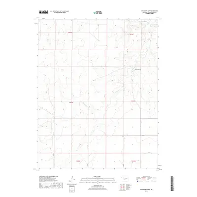
2018 Map of Autograph Cliff
USGS Topo · Published 2018About this map
Autograph Cliff stands as a prominent landmark in this high-plains landscape of Cimarron County, where the elevation changes reveal a complex system of draws and ridges. The drainage of Cold Springs Cr winds through the territory, dictating the sparse but deliberate layout of the rural road network. This 2018 survey by the U.S. Geological Survey illustrates the section-line grid system typical of the Oklahoma Panhandle, with routes such as E0095 Rd and N0210 Rd providing the primary transit for this ranching and agricultural region. The map preserves the specific survey boundaries of Townships 3, 4, and 5 North, across Ranges 3 and 4 East, showing how modern infrastructure continues to follow the historical divisions of the Public Land Survey System.
Find a feature on this map
17 named features on this map. Tap any name to fly to it.
Don’t see what you’re looking for? This feature index may not catch every label — zoom into the map to look around manually.
Map Details
Editions of this 2018 Autograph Cliff Map
This is the sole edition of this map. No revisions or reprints were ever made.
Other maps of this area

1954 · Dalhart
USGS Topo · 1:250,000

1958 · Dalhart
USGS Topo · 1:250,000

1962 · Dalhart
USGS Topo · 1:250,000

1968 · Autograph Cliff NW
USGS Topo · 1:24,000

1969 · Boise City
USGS Topo · 1:24,000

1969 · Boise City NW
USGS Topo · 1:24,000

1969 · Flagg Springs
USGS Topo · 1:24,000

1969 · Felt NE
USGS Topo · 1:24,000

1969 · Kenton SE
USGS Topo · 1:24,000
1969 · Autograph Cliff
USGS Topo · 1:24,000