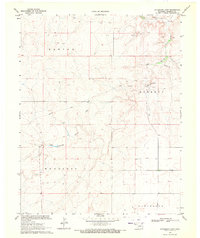
1969 Map of Autograph Cliff
USGS Topo · Published 1971About this map
Autograph Cliff stands as a prominent landmark in this corner of Cimarron County, overlooking a landscape defined by the historic passage of the Santa Fe Trail. The map documents a sparsely populated region of the Oklahoma Panhandle during the late 1960s, where the drainages of Cold Springs Creek dictate the layout of ranching and transport. Small rural hubs including Kenton, Garrett, Wheeless, and Cleveland are distributed across the high plains, connected by a network of unimproved roads and trails. The presence of a Gravel Pit and Sandpit suggests localized resource extraction typical of the era, while the overall settlement pattern remains tied to the terrain's water sources and the legacy of the old wagon route that once moved pioneers and trade through this high-altitude corridor.
Find a feature on this map
10 named features on this map. Tap any name to fly to it.
Don’t see what you’re looking for? This feature index may not catch every label — zoom into the map to look around manually.
Map Details
Editions of this 1969 Autograph Cliff Map
This is the sole edition of this map. No revisions or reprints were ever made.
Other maps of this area

1954 · Dalhart
USGS Topo · 1:250,000

1958 · Dalhart
USGS Topo · 1:250,000

1962 · Dalhart
USGS Topo · 1:250,000

1968 · Autograph Cliff NW
USGS Topo · 1:24,000

1969 · Boise City
USGS Topo · 1:24,000

1969 · Boise City NW
USGS Topo · 1:24,000

1969 · Flagg Springs
USGS Topo · 1:24,000

1969 · Felt NE
USGS Topo · 1:24,000

1969 · Kenton SE
USGS Topo · 1:24,000
1969 · Kenton NE
USGS Topo · 1:24,000