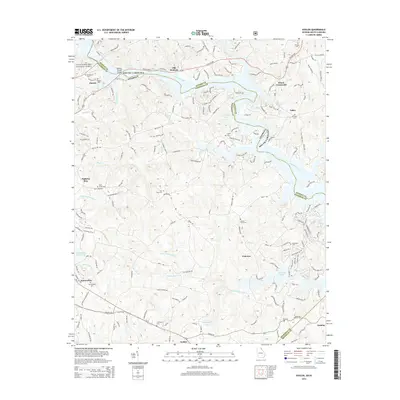
2014 Map of Avalon
USGS Topo · Published 2014About this map
The Tugalo River valley forms the centerpiece of this Georgia and South Carolina borderlands survey, where the rising waters of Hartwell Lake have transformed the landscape into a network of jagged peninsulas and deep coves. The area is defined by its small crossroads communities and rural settlements, including Old Madison, Dixon Crossroads, and Avalon. These settlements are linked by a complex web of mountain trails and highway systems, such as Toccoa Hwy and the Lee Mountain Trl.
Find a feature on this map
177 named features on this map. Tap any name to fly to it.
Don’t see what you’re looking for? This feature index may not catch every label — zoom into the map to look around manually.
Map Details
Editions of this 2014 Avalon Map
This is the sole edition of this map. No revisions or reprints were ever made.
Other maps of this area

1886 · Walhalla
USGS Topo · 1:125,000

1891 · Carnesville
USGS Topo · 1:125,000

1892 · Walhalla
USGS Topo · 1:125,000

1896 · Walhalla
USGS Topo · 1:125,000

1954 · Greenville
USGS Topo · 1:250,000

1957 · Tugaloo Lake
USGS Topo · 1:24,000

1958 · Greenville
USGS Topo · 1:250,000

1959 · Lavonia
USGS Topo · 1:24,000

1960 · Martin
USGS Topo · 1:24,000
1963 · Westminster
USGS Topo · 1:24,000