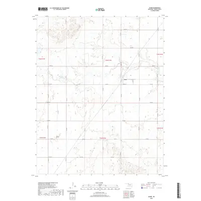
2018 Map of Avard
USGS Topo · Published 2018About this map
Avard serves as the central hub of this Woods County landscape, situated at a junction where local roads like Virginia St and Co Rd 370 intersect. The terrain is defined by a series of intermittent waterways and drainage basins, most notably Eagle Chief Cr which flows past the settlement. Water management is a visible priority in the region, evidenced by the presence of Buckland Reservoir and Avard Lake. For those researching local heritage, the Memorial Hill Cem stands as a significant landmark in the southwest, located near the headwaters of Dog Cr. The map reveals a highly structured grid of section lines and township boundaries, including t26n r15w, which organize the agricultural and ranching lands that dominate the surrounding territory.
Find a feature on this map
30 named features on this map. Tap any name to fly to it.
Don’t see what you’re looking for? This feature index may not catch every label — zoom into the map to look around manually.
Map Details
Editions of this 2018 Avard Map
This is the sole edition of this map. No revisions or reprints were ever made.
Other maps of this area

1955 · Woodward
USGS Topo · 1:250,000

1958 · Woodward
USGS Topo · 1:250,000

1969 · Tegarden SE
USGS Topo · 1:24,000

1969 · Dacoma SW
USGS Topo · 1:24,000

1969 · Waynoka NW
USGS Topo · 1:24,000

1969 · Hopeton
USGS Topo · 1:24,000

1969 · Avard
USGS Topo · 1:24,000

1969 · Waynoka East
USGS Topo · 1:24,000

1969 · Tegarden
USGS Topo · 1:24,000

1969 · Waynoka West
USGS Topo · 1:24,000