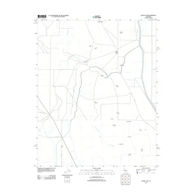
2012 Map of Avenal Gap
USGS Topo · Published 2012About this map
The Governor Edmund G Brown California Aqueduct dominates the eastern landscape of this 2012 survey, cutting a straight, engineered path across the arid terrain of Kern County. This region is defined by a series of low-lying hills and dry washes, including the prominent Avenal Gap and the water-carved Arroyo Ancho. Small, rural settlements such as La Zanja, El Vejón, and Devils Den are scattered throughout, connected by a network of local roads like Pyramid Hills Rd and Devils Den Rd. The landscape exhibits a transition between the elevated relief of Pintojo Ridge and Boulder Hill and the flatter expanses of Pepper Grass Valley. This map documents a modern snapshot of California's water infrastructure and the persistent, sparse settlement patterns within its interior valleys, where names like Alamo Solo Spring hint at the critical importance of water in this environment.
Find a feature on this map
32 named features on this map. Tap any name to fly to it.
Don’t see what you’re looking for? This feature index may not catch every label — zoom into the map to look around manually.
Map Details
Editions of this 2012 Avenal Gap Map
This is the sole edition of this map. No revisions or reprints were ever made.
Other maps of this area

1914 · Lost Hills
USGS Topo · 1:125,000

1914 · Cholame
USGS Topo · 1:125,000

1915 · Cholame
USGS Topo · 1:125,000

1917 · Cholame
USGS Topo · 1:125,000

1930 · Avenal Gap
USGS Topo · 1:31,680

1930 · Kettleman Plain
USGS Topo · 1:31,680

1930 · Middle Dome
USGS Topo · 1:31,680

1932 · Dudley Ridge
USGS Topo · 1:31,680

1932 · Antelope Plain
USGS Topo · 1:31,680

1932 · West Camp
USGS Topo · 1:31,680