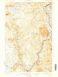
1929 Map of Averill
USGS Topo · Published 1929About this map
Canaan and Beecher Falls anchor the northern reaches of this borderlands landscape, where the Vermont-New Hampshire line follows the winding course of the Connecticut River. The late 1920s topography reveals a heavily managed timber and water environment, evidenced by a dense network of logging camps and dams—such as Camp No 20 and Buzzell Dam—supporting the river-driven economy. Along the eastern edge, the Maine Central Railroad serves the corridor between West Stewartstown and North Stratford, passing the County Farm and a local Fish Hatchery. Deep in the interior, large water bodies like Averill Lake and Little Averill Lake are framed by peaks including Averill Mtn and Brousseau Mtn. Local education is well-represented by rural institutions like Blodgett Sch and South Canaan Sch, while genealogists will find landmarks such as the Alice Hunt Cemetery and County Cem preserved near the river valley.
Find a feature on this map
140 named features on this map. Tap any name to fly to it.
Don’t see what you’re looking for? This feature index may not catch every label — zoom into the map to look around manually.
Map Details
Editions of this 1929 Averill Map
5 editions found
Other maps of this area

1920 · Guildhall
USGS Topo · 1:62,500

1924 · Island Pond
USGS Topo · 1:48,000

1925 · Indian Stream
USGS Topo · 1:48,000

1926 · Island Pond
USGS Topo · 1:62,500

1926 · Indian Stream
USGS Topo · 1:62,500

1927 · Indian Stream
USGS Topo · 1:62,500

1929 · Averill
USGS Topo · 1:62,500

1930 · Percy
USGS Topo · 1:62,500

1930 · Dixville
USGS Topo · 1:62,500

1931 · Guildhall
USGS Topo · 1:48,000