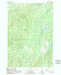
1986 Map of Avery
USGS Topo · Published 1986About this map
Mackinaw State Forest dominates this northern Michigan landscape, where a dense network of water bodies and timber-focused infrastructure defines the terrain. The presence of an Old Railroad Grade cutting across the central hills reflects the region's historical reliance on logging transport, connecting the upper reaches of the Thunder Bay River with the settlement at Avery. The topography is characterized by intricate drainage systems, with Gilchrist Creek, Nugent Creek, and Hunt Creek feeding into the larger river network. To the east, Lockwood Lake and its associated Lockwood Creek offer a distinct focal point for local geography. Small-scale industrial activity is noted at a Gravel Pit near the southern boundary, while Blue Lake sits in the southwestern portion of the forest, illustrating the typical kettle-lake geology of Montmorency County during the mid-1980s.
Find a feature on this map
18 named features on this map. Tap any name to fly to it.
Don’t see what you’re looking for? This feature index may not catch every label — zoom into the map to look around manually.
Map Details
Editions of this 1986 Avery Map
This is the sole edition of this map. No revisions or reprints were ever made.
Other maps of this area

1954 · Traverse City
USGS Topo · 1:250,000

1954 · Tawas City
USGS Topo · 1:250,000

1954 · Alpena
USGS Topo · 1:250,000

1955 · Atlanta
USGS Topo · 1:62,500

1955 · Comins
USGS Topo · 1:62,500

1955 · Hillman
USGS Topo · 1:62,500

1955 · Cheboygan
USGS Topo · 1:250,000

1957 · Alpena
USGS Topo · 1:250,000

1958 · Cheboygan
USGS Topo · 1:250,000

1958 · Traverse City
USGS Topo · 1:250,000