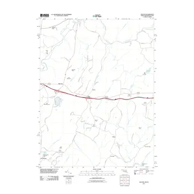
2011 Map of Avilton
USGS Topo · Published 2011About this map
New Germany State Park anchor the southwestern corner of this landscape, where the New Germany State Park Dam forms New Germany Lake amidst the high terrain of Salt Block Mountain and Red Ridge. Moving north through the high country of Chestnut Ridge, the area is defined by a series of north-flowing watercourses including the Casselman River and Meadow Run. The distribution of local history is visible through a network of small family and community burial sites such as Saint Anns Cemetery, Merrbach Cemetery, and Blocher Cemetery. This region reflects a pattern of high-elevation settlements and farmsteads connected by rural corridors like Old Route 219 and Greenville Rd. In the east, the Frostburg Reservoir and its Big Piney Run Dam highlight the engineering of water resources for the surrounding area, while the rural communities of Piney Grove and Avilton sit along established mountain roads.
Find a feature on this map
96 named features on this map. Tap any name to fly to it.
Don’t see what you’re looking for? This feature index may not catch every label — zoom into the map to look around manually.
Map Details
Editions of this 2011 Avilton Map
This is the sole edition of this map. No revisions or reprints were ever made.
Other maps of this area

1898 · Frostburg
USGS Topo · 1:62,500

1899 · Grantsville
USGS Topo · 1:62,500

1901 · Frostburg
USGS Topo · 1:62,500

1904 · Grantsville
USGS Topo · 1:62,500

1908 · Frostburg
USGS Topo · 1:62,500

1921 · Meyersdale
USGS Topo · 1:62,500

1923 · Berlin
USGS Topo · 1:48,000

1929 · Berlin
USGS Topo · 1:62,500

1939 · Meyersdale
USGS Topo · 1:62,500

1944 · Berlin
USGS Topo · 1:62,500