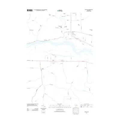
2013 Map of Avoca
USGS Topo · Published 2013About this map
The Wisconsin River dominates this landscape, carving a wide path through the region and separating the village of Avoca from the community of Gotham to the north. This 2013 survey illustrates a deeply rooted agricultural economy, specifically noted by the numerous named livestock and dairy operations that define the rural sections. Genealogists and local historians can locate specific family-linked enterprises such as the Atwood Stock, Dairy and Grain Farm, the Walnut Grove Stock and Dairy Farm, and the Moss Creek Stock Farm. North of the river, the terrain rises into the distinctive Riverview Ridge and Bogus Bluff, while the Pine River feeds into the main channel near the Pine River Trl. The map also captures the local drainage patterns of several coulees and creeks, including Norway Hollow Cr, Marsh Cr, and the secluded Onion Hollow.
Find a feature on this map
74 named features on this map. Tap any name to fly to it.
Don’t see what you’re looking for? This feature index may not catch every label — zoom into the map to look around manually.
Map Details
Editions of this 2013 Avoca Map
This is the sole edition of this map. No revisions or reprints were ever made.
Other maps of this area

1905 · Richland Center
USGS Topo · 1:125,000

1958 · La Crosse
USGS Topo · 1:250,000

1960 · Richland Center
USGS Topo · 1:62,500

1960 · Plain
USGS Topo · 1:62,500

1960 · Muscoda
USGS Topo · 1:62,500

1960 · Spring Green
USGS Topo · 1:62,500

1961 · La Crosse
USGS Topo · 1:250,000

1965 · La Crosse
USGS Topo · 1:250,000

1976 · La Crosse
USGS Topo · 1:250,000
1983 · Highland West
USGS Topo · 1:24,000