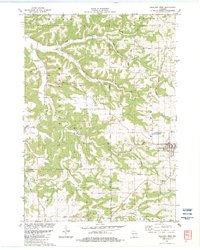
1983 Map of Highland West
USGS Topo · Published 1983About this map
Bohemian Ridge and the Blue River Valley define this portion of the Wisconsin Driftless Area, where deep valleys and prominent limestone outcrops shaped early settlement patterns. By the early 1980s, the village of Highland served as the primary hub, while smaller legacy hamlets like Centerville remained situated at key road junctions. The landscape is marked by steep ridges and narrow hollows, such as Irish Hollow Branch and Big Spring Branch, which were critical for early farm placement and water access. Landmarks like St Johns Ch and Blue River Valley Ch anchor the rural community, reflecting the area's ethnic settlement history. Several Quarry sites throughout the quadrangle suggest a persistent local extraction industry, while geographic features like Big Rock and Sunset Rock provide distinctive navigational markers across the township lines of Pulaski, Castle Rock, and Wingville.
Find a feature on this map
37 named features on this map. Tap any name to fly to it.
Don’t see what you’re looking for? This feature index may not catch every label — zoom into the map to look around manually.
Map Details
Editions of this 1983 Highland West Map
This is the sole edition of this map. No revisions or reprints were ever made.
Other maps of this area

1900 · Lancaster
USGS Topo · 1:125,000

1902 · Mineral Point
USGS Topo · 1:125,000

1904 · Lancaster
USGS Topo · 1:125,000

1905 · Richland Center
USGS Topo · 1:125,000

1908 · Lancaster
USGS Topo · 1:125,000

1933 · Boscobel
USGS Topo · 1:62,500

1952 · Montfort
USGS Topo · 1:24,000

1952 · Linden
USGS Topo · 1:24,000

1958 · La Crosse
USGS Topo · 1:250,000

1959 · Dubuque
USGS Topo · 1:250,000