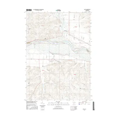
2016 Map of Avoca
USGS Topo · Published 2016About this map
The Wisconsin River serves as the dividing line between Richland and Iowa Counties in this 2016 survey, a landscape defined by significant elevation changes between the river valley and the surrounding ridges. To the north, the settlement of Gotham sits near the base of Onion Hollow and Bogus Bluff, while the village of Avoca lies to the south on the river's edge. This area is characterized by a network of deep hollows and high ridges, including Riverview Ridge and Dry Dog Ridge, which dictate the placement of local roads and property lines.
Find a feature on this map
76 named features on this map. Tap any name to fly to it.
Don’t see what you’re looking for? This feature index may not catch every label — zoom into the map to look around manually.
Map Details
Editions of this 2016 Avoca Map
This is the sole edition of this map. No revisions or reprints were ever made.
Other maps of this area

1905 · Richland Center
USGS Topo · 1:125,000

1958 · La Crosse
USGS Topo · 1:250,000

1960 · Richland Center
USGS Topo · 1:62,500

1960 · Plain
USGS Topo · 1:62,500

1960 · Muscoda
USGS Topo · 1:62,500

1960 · Spring Green
USGS Topo · 1:62,500

1961 · La Crosse
USGS Topo · 1:250,000

1965 · La Crosse
USGS Topo · 1:250,000

1976 · La Crosse
USGS Topo · 1:250,000
1983 · Highland West
USGS Topo · 1:24,000