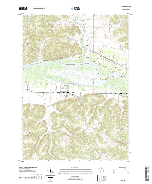
2022 Map of Avoca
USGS Topo · Published 2022About this map
The Wisconsin River corridor defines this portion of the Driftless Area, where the river serves as a natural boundary between Richland and Iowa Counties. On its southern bank, the village of Avoca sits on a low terrace protected from the seasonal flow of Marsh Creek, which meanders through the wetlands to the west. Across the river, the settlement of Gotham marks the confluence where the Pine River joins the main channel.
Find a feature on this map
76 named features on this map. Tap any name to fly to it.
Don’t see what you’re looking for? This feature index may not catch every label — zoom into the map to look around manually.
Map Details
Editions of this 2022 Avoca Map
This is the sole edition of this map. No revisions or reprints were ever made.
Other maps of this area

1905 · Richland Center
USGS Topo · 1:125,000

1958 · La Crosse
USGS Topo · 1:250,000

1960 · Richland Center
USGS Topo · 1:62,500

1960 · Plain
USGS Topo · 1:62,500

1960 · Muscoda
USGS Topo · 1:62,500

1960 · Spring Green
USGS Topo · 1:62,500

1961 · La Crosse
USGS Topo · 1:250,000

1965 · La Crosse
USGS Topo · 1:250,000

1976 · La Crosse
USGS Topo · 1:250,000
1983 · Highland West
USGS Topo · 1:24,000