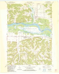
1983 Map of Avoca
USGS Topo · Published 1983About this map
The Wisconsin River dominates this landscape, carving a wide valley between the townships of Orion, Buena Vista, and Pulaski. The river's influence is clear in the broad wetlands of the Lower Wisconsin River State Wildlife Area, where Marsh Creek and Avoca Lake sit within the floodplain. On the northern banks, the settlement of Gotham marks the intersection of the river and the Pine River, while the village of Avoca sits to the south along the Wisconsin Western Ave rail corridor.
Find a feature on this map
47 named features on this map. Tap any name to fly to it.
Don’t see what you’re looking for? This feature index may not catch every label — zoom into the map to look around manually.
Map Details
Editions of this 1983 Avoca Map
This is the sole edition of this map. No revisions or reprints were ever made.
Other maps of this area

1905 · Richland Center
USGS Topo · 1:125,000

1958 · La Crosse
USGS Topo · 1:250,000

1960 · Richland Center
USGS Topo · 1:62,500

1960 · Plain
USGS Topo · 1:62,500

1960 · Muscoda
USGS Topo · 1:62,500

1960 · Spring Green
USGS Topo · 1:62,500

1961 · La Crosse
USGS Topo · 1:250,000

1965 · La Crosse
USGS Topo · 1:250,000

1976 · La Crosse
USGS Topo · 1:250,000
1983 · Highland West
USGS Topo · 1:24,000