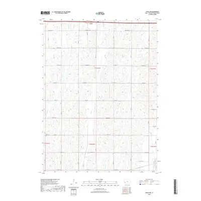
2018 Map of Avoca NW
USGS Topo · Published 2018About this map
The agricultural landscape of Pottawattamie County is defined by a dense network of creek valleys and section-line roads. Shelby sits at the northern edge of this survey, where the rolling terrain begins its descent toward the West Nishnabotna River in the southeast corner. The hydrology is dominated by the parallel courses of Middle Silver Cr, Silver Cr, and Slocum Cr, which carve the loess hills into a series of north-south ridges.
Find a feature on this map
21 named features on this map. Tap any name to fly to it.
Don’t see what you’re looking for? This feature index may not catch every label — zoom into the map to look around manually.
Map Details
Editions of this 2018 Avoca NW Map
This is the sole edition of this map. No revisions or reprints were ever made.
Other maps of this area

1954 · Omaha
USGS Topo · 1:250,000

1956 · Neola
USGS Topo · 1:24,000

1957 · Omaha
USGS Topo · 1:250,000

1957 · Taylor
USGS Topo · 1:24,000

1958 · Omaha
USGS Topo · 1:250,000

1963 · Avoca NW
USGS Topo · 1:24,000

1963 · Avoca SE
USGS Topo · 1:24,000

1963 · Oakland
USGS Topo · 1:24,000

1963 · Avoca
USGS Topo · 1:24,000

1978 · Corley
USGS Topo · 1:24,000