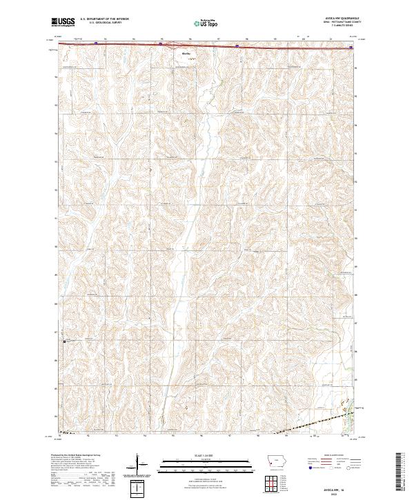
2022 Map of Avoca NW
USGS Topo · Published 2022About this map
Shelby sits at the northern edge of this agricultural landscape in Pottawattamie County, where the terrain is defined by a series of north-south drainage systems. The local geography is shaped by the parallel courses of Middle Silver Cr and Silver Cr, which carve through the loess hills of western Iowa before meeting the West Nishnabotna River in the southeast corner. The section lines are clearly marked by a rhythmic grid of roads named for various flora, including Whippoorwill Rd, Tamarack Rd, and Sycamore Rd. For those researching family history in the township, the Silver Valley Cem is a primary landmark situated along Pinoak Rd. This map illustrates the intersection of modern interstate travel with the traditional section-line road network that has organized this farming community for generations.
Find a feature on this map
22 named features on this map. Tap any name to fly to it.
Don’t see what you’re looking for? This feature index may not catch every label — zoom into the map to look around manually.
Map Details
Editions of this 2022 Avoca NW Map
This is the sole edition of this map. No revisions or reprints were ever made.
Other maps of this area

1954 · Omaha
USGS Topo · 1:250,000

1956 · Neola
USGS Topo · 1:24,000

1957 · Omaha
USGS Topo · 1:250,000

1957 · Taylor
USGS Topo · 1:24,000

1958 · Omaha
USGS Topo · 1:250,000

1963 · Avoca NW
USGS Topo · 1:24,000

1963 · Avoca SE
USGS Topo · 1:24,000

1963 · Oakland
USGS Topo · 1:24,000

1963 · Avoca
USGS Topo · 1:24,000

1978 · Corley
USGS Topo · 1:24,000