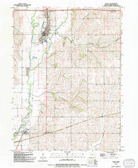
1994 Map of Avoca
USGS Topo · Published 1994About this map
Avoca and Hancock anchor this portion of Pottawattamie County, situated along the valley of the West Nishnabotna River. The town of Avoca is characterized by a dense grid of streets featuring the United Church and Avoha High Sch, while Graceland Cem sits just to the north. The landscape is defined by the river’s winding course and its tributaries, including the East Branch, Graybill Creek, and Bedell Creek.
Find a feature on this map
21 named features on this map. Tap any name to fly to it.
Don’t see what you’re looking for? This feature index may not catch every label — zoom into the map to look around manually.
Map Details
Editions of this 1994 Avoca Map
This is the sole edition of this map. No revisions or reprints were ever made.
Other maps of this area

1954 · Omaha
USGS Topo · 1:250,000

1957 · Omaha
USGS Topo · 1:250,000

1958 · Omaha
USGS Topo · 1:250,000

1963 · Avoca NW
USGS Topo · 1:24,000

1963 · Avoca SE
USGS Topo · 1:24,000

1963 · Oakland
USGS Topo · 1:24,000

1963 · Avoca
USGS Topo · 1:24,000

1971 · Walnut
USGS Topo · 1:24,000

1971 · Atlantic SW
USGS Topo · 1:24,000

1978 · Corley
USGS Topo · 1:24,000