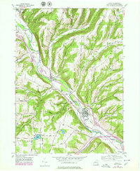
1953 Map of Avoca
USGS Topo · Published 1978About this map
The Cohocton River valley serves as the primary corridor for transportation and settlement in this portion of Steuben County, as recorded in a 1953 survey with 1970s updates. The village of Avoca sits at a significant rail junction where the Erie Lackawanna Railroad meets the Bath and Hammondsport Railroad, illustrating the area's importance to regional freight and transit. Moving northwest, the valley floor accommodates smaller clusters like Wallace and Bloomerville, while the surrounding uplands are defined by family-named landmarks such as Wentworth Road and Canoe Hill.
Find a feature on this map
40 named features on this map. Tap any name to fly to it.
Don’t see what you’re looking for? This feature index may not catch every label — zoom into the map to look around manually.
Map Details
Editions of this 1953 Avoca Map
4 editions found
Other maps of this area

1900 · Naples
USGS Topo · 1:62,500

1902 · Wayland
USGS Topo · 1:62,500

1903 · Naples
USGS Topo · 1:62,500

1904 · Wayland
USGS Topo · 1:62,500

1910 · Bath
USGS Topo · 1:62,500

1913 · Naples
USGS Topo · 1:62,500

1915 · Hornell
USGS Topo · 1:62,500

1918 · Hornell
USGS Topo · 1:62,500

1942 · Wayland
USGS Topo · 1:31,680

1942 · Naples
USGS Topo · 1:31,680