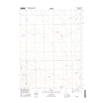
2017 Map of Avon SE
USGS Topo · Published 2017About this map
The Escalante Desert dominates the northern landscape of this Iron County region, transitioning into the higher elevations of the Antelope Range and Three Peaks in the southwest. This 2017 survey documents a high-desert environment defined by seasonal drainage patterns, where Iron Springs Cr and Big Hollow Wash cut through the arid terrain. The land is marked by distinct topographical landmarks such as Tucker Point and Upper Point, which serve as navigational anchors in the open basin.
Find a feature on this map
19 named features on this map. Tap any name to fly to it.
Don’t see what you’re looking for? This feature index may not catch every label — zoom into the map to look around manually.
Map Details
Editions of this 2017 Avon SE Map
This is the sole edition of this map. No revisions or reprints were ever made.
Other maps of this area

1885 · St. George
USGS Topo · 1:250,000

1891 · St. George
USGS Topo · 1:250,000

1949 · Cedar City NW
USGS Topo · 1:24,000

1950 · Cedar City NW
USGS Topo · 1:24,000

1950 · Antelope Peak
USGS Topo · 1:24,000

1950 · Enoch
USGS Topo · 1:62,500

1950 · Iron Mountain
USGS Topo · 1:62,500

1950 · Cedar City
USGS Topo · 1:62,500

1950 · The Three Peaks
USGS Topo · 1:24,000

1950 · Silver Peak
USGS Topo · 1:24,000